Optimizing Offshore Geophysical Survey Workflows
The Urgent Need for Efficiency in Offshore Geophysical Surveys
Offshore geophysical surveys are crucial for resource exploration and environmental evaluations. However, inefficiencies in these operations may result in substantial financial losses. For example, research indicates that downtimes can cost companies more than $100,000 daily. Additionally, extended surveys can cause greater environmental disruption, affecting marine ecosystems.
In recent years, technological advancements have opened doors for improving workflow efficiency. Innovations such as artificial intelligence and automation are beginning to shape how surveys are planned and executed. This guide will explore these enhancements, offering insights into how to derive the most value from offshore geophysical surveys.
The Promise of Streamlined Offshore Geophysical Surveys
Streamlined processes can improve speed and accuracy, leading to more reliable data collection and analysis. Optimizing each step of the workflow ensures that projects become both time and cost-efficient.
Data Acquisition Optimization: Maximizing Efficiency in the Field
Streamlining Data Acquisition Planning and Logistics
Successful offshore surveys start with meticulous planning. A comprehensive plan helps in anticipating challenges and reduces potential delays. Key best practices include:
- Vessel Selection: Choose vessels based on survey type and environmental conditions.
- Crew Management: Ensure a skilled crew is available, ready to adapt to field conditions.
For example, a project in the North Sea improved its logistics by closely assessing weather patterns and vessel capabilities, leading to a reduction in survey time by over 20%.
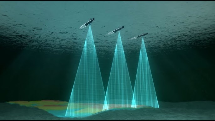
Implementing Advanced Sensor Technologies and Data Acquisition Techniques
The role of advanced sensors cannot be underestimated. They not only improve data quality but also expedite acquisition times. Implementing tools like multi-beam sonar or 3D seismic imaging can yield remarkable results. Consider these tips for selecting the right technology:
- Assess the specific project needs.
- Investigate emerging sensor technologies.
- Stay updated on industry standards.
Innovative data acquisition techniques also include autonomous underwater vehicles (AUVs) which can cover large areas quickly and efficiently.
Real-Time Data Processing and Quality Control
Real-Time Data Monitoring and Pre-processing
Real-time data analysis enhances the ability to make quick decisions during surveys. This means that teams can address data quality issues as they arise instead of waiting until post-survey analysis.
To implement real-time data processing:
- Utilize onboard data processing systems.
- Train teams on data interpretation methods.
- Establish protocols for immediate feedback loops.
Automated Quality Control Measures and Anomaly Detection
AI and automation are vital for quality control in offshore surveys. Automated systems can identify anomalies instantly, reducing human error and improving data reliability.
For example, integrating machine learning techniques in quality control has improved detection rates of inconsistencies by nearly 30%. To drive automation into quality control, consider:
- Implementing specialized software.
- Training staff on automated QC systems.
- Regularly updating algorithms to adapt to new data types.
Integration of Advanced Analytics and Interpretation Techniques
Applying AI and Machine Learning to Geophysical Data Interpretation
AI and machine learning can transform how geophysical data is interpreted. These technologies analyze large datasets quickly, uncovering patterns that human analysts may miss. One expert in the field noted, "AI helps us make sense of complex data faster and more accurately than traditional methods."
Successful applications of AI include predictive modeling that forecasts geological formations based on previous survey data. This leads to improved accuracy and efficiency in decision-making.
Optimizing Interpretation Workflows Through Automation and Collaboration
Automation not only speeds up but also improves the quality of interpretation workflows. Modern software tools can integrate various data sources, allowing teams to collaborate easily.
To enhance collaboration among interpreters:
- Use cloud-based platforms for data sharing.
- Establish clear communication protocols.
- Encourage regular check-ins for progress updates.
Enhancing Communication and Collaboration: Breaking Down Silos
Implementing Seamless Data Sharing and Communication Platforms
Cloud-based data management solutions facilitate better collaboration between offshore and onshore teams. These platforms provide access to real-time data, reducing delays.
Successful implementations often lead to better project outcomes. For example, a company that adopted a cloud solution saw a 25% reduction in project turnaround time.
Fostering Effective Communication Between Teams
Effective communication is crucial for smooth operations during surveys. Here are strategies to improve communication:
- Schedule regular team briefings.
- Utilize messaging apps for quick feedback.
- Create detailed communication protocols.
Consistent communication helps maintain alignment and boosts team morale, ultimately leading to a more successful survey operation.
Case Studies: Real-World Examples of Optimized Offshore Geophysical Surveys
Case Study 1: Successful Implementation of Real-Time Data Processing
A leading geophysical firm invested in real-time data processing technology for a survey in the Gulf of Mexico. By utilizing this technology, they identified and addressed data quality issues as they occurred. Resulting efficiency improvements led to a 35% reduction in project time, saving the company both time and resources.
Case Study 2: Leveraging AI for Improved Data Interpretation
Another company employed AI algorithms to interpret seismic data in an offshore project. The result was a significant accuracy boost in geological prediction, increasing their hit rate on resource discoveries. Key lessons included the need for ongoing algorithm training and data validation.
Conclusion: The Future of Optimized Offshore Geophysical Surveys
Key Takeaways and Best Practices
Efficiency in offshore geophysical surveys is achievable through careful planning, advanced technology use, and clear communication. The benefits of optimized workflows are undeniable, including reduced costs and improved data accuracy.
Call to Action: Embracing Efficiency for a Sustainable Future in Offshore Geophysical Surveys
To remain competitive, it is essential to embrace the strategies discussed. Implementing these measures will pave the way for a sustainable future in offshore geophysical surveys, ensuring minimal environmental impact while maximizing productivity. Take the first step towards optimizing workflows today!